
 Search
 Feedback
 About
About Help
Help News
News
| Listing 1 - 10 of 18 | << page >> |
Sort by
|
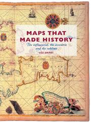
ISBN: 1281970220 9786611970222 1554882249 9781554882243 9781459712546 1459712544 1550025627 9781550025620 1903365643 9781903365649 Year: 2004 Publisher: Toronto Dundurn Group
Abstract | Keywords | Export | Availability | Bookmark
 Loading...
Choose an application
- Reference Manager
- EndNote
- RefWorks (Direct export to RefWorks)
Features 25 glorious maps that chart societies, land, sea, and skies; maps that have influenced and inspired; and maps that misrepresent.
Periodical
ISSN: 03085694 14797801 Year: 1935 Publisher: Berlin
Abstract | Keywords | Export | Availability | Bookmark
Loading...Choose an application
- Reference Manager
- EndNote
- RefWorks (Direct export to RefWorks)
Imago Mundi is the only English-language scholarly periodical devoted exclusively to the history of pre-modern maps, mapping, and map-related ideas from anywhere in the world. It was founded in Berlin in 1935 by the Russian émigré Leo Bagrow as an annual publication, although only five volumes appeared between 1935 and 1948. From 1975 to 2003 publication was regular. In 2004 Imago Mundi became a biannual publication. The first volume was in German. Thereafter English was used with, very occasionally, French. After 2002 (volume 54) Imago Mundi publishes exclusively in English with foreign language abstracts (currently French, German, and Spanish). A multi-disciplinary approach was adopted in 1995. All articles represent original research, are refereed, and are well illustrated (recent volumes have included color plates). Since 1977 each volume has contained a full complement of scholarly aids in the form of book reviews, bibliography, and chronicles, all of which have made Imago Mundi a valuable journal of record as well as scholarship.
cartografie --- Cartography --- Early maps --- Cartographie --- Cartes anciennes --- Architecture, Fine and Decorative Arts. --- Arts and Humanities. --- Arts and Humanities --- Earth Sciences --- Architecture, Fine and Decorative Arts --- History --- Geodesy. Cartography --- 912 <09> --- 912 <05> --- Cartografie. Kaarten. Plattegronden. Atlassen--Geschiedenis van ... --- Cartografie. Kaarten. Plattegronden. Atlassen--Tijdschriften --- Periodicals --- Cartography. --- Early maps. --- History (General) --- Geography & Cartography. --- Maps, Early --- Geography --- Cartography, Primitive --- Chartography --- Map-making --- Mapmaking --- Mapping (Cartography) --- Mathematical geography --- Surveying --- Map projection --- Maps --- cartography [discipline] --- Cartografie. Kaarten. Plattegronden. Atlassen--Geschiedenis van .. --- Cartografie. Kaarten. Plattegronden. Atlassen--Geschiedenis van . --- Cartografie. Kaarten. Plattegronden. Atlassen--Geschiedenis van --- Cartography - Periodicals. --- Early maps - Periodicals. --- Cartographie - Périodiques. --- Cartes anciennes - Périodiques.
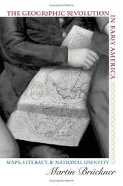
ISBN: 0807830003 9780807830000 080785672X 9780807856727 9781469601014 146960101X 0807838977 9798890878038 Year: 2006 Publisher: Chapel Hill University of North Carolina Press
Abstract | Keywords | Export | Availability | Bookmark
Loading...Choose an application
- Reference Manager
- EndNote
- RefWorks (Direct export to RefWorks)
The rapid rise in popularity of maps and geography handbooks in the eighteenth century ushered in a new geographic literacy among non elite Americans. In a path breaking and richly illustrated examination of this transformation, Martin Brückner argues that geographic literacy as it was played out in popular literary genres significantly influenced the formation of identity in America from the 1680s to the 1820s. Drawing on historical geography, cartography, literary history, and material culture, Brückner recovers a vibrant culture of geography consisting of property plats and surveying manuals, decorative wall maps and school geographies, the nation's first atlases, and sentimental objects such as needlework samplers. By showing how this geographic revolution affected the production of literature, Brückner demonstrates that the internalization of geography as a kind of language helped shape the literary construction of the modern American subject.
Book
ISBN: 9004400893 9789004400894 9004400885 9789004400887 Year: 2020 Publisher: Leiden Boston : BRILL,
Abstract | Keywords | Export | Availability | Bookmark
Loading...Choose an application
- Reference Manager
- EndNote
- RefWorks (Direct export to RefWorks)
"When does a depiction of the moon become a lunar map? This publication addresses this question from theoretical and historical standpoints. It is argued that moon maps are of crucial importance to the history of cartography, for they challenge established notions of what a map is, how it functions, what its purposes are, and what kind of power it embodies and performs. The publication also shows how terrestrial cartography has shaped the history of lunar mapping since the seventeenth century, through visual and nomenclature conventions, the cultural currency of maps, mapmakers' social standing, and data-gathering and projection practices. It further demonstrates that lunar cartography has also been organized by an internal principle that is born of the fundamental problem of how to create static map spaces capable of representing a referent that is constantly changing to our eyes, as is the visible face of the moon. It is suggested that moon maps may be classed in three broad categories, according to the kinds of solutions for this representational problem that have been devised over the last 400 years".
912:523.34 --- 912 <09> --- History --- 912:523.34 Cartografie. Kaarten. Plattegronden. Atlassen-:-Moon. Selenology --- 912:523.34 Cartography. Maps. Atlasses-:-Moon. Selenology --- Cartografie. Kaarten. Plattegronden. Atlassen-:-Moon. Selenology --- Cartography. Maps. Atlasses-:-Moon. Selenology --- Annals --- Auxiliary sciences of history --- 912 <09> Cartografie. Kaarten. Plattegronden. Atlassen--Geschiedenis van ... --- 912 <09> Cartography. Maps. Atlasses--Geschiedenis van ... --- Cartografie. Kaarten. Plattegronden. Atlassen--Geschiedenis van ... --- Cartography. Maps. Atlasses--Geschiedenis van ... --- Cartografie. Kaarten. Plattegronden. Atlassen--Geschiedenis van . --- History of cartography. --- E-books --- Cartografie. Kaarten. Plattegronden. Atlassen--Geschiedenis van --- History. --- Moon --- Maps --- Earth (Planet) --- Satellite --- Solar system --- Geodesy. Cartography --- historical maps --- anno 1600-1699 --- anno 1800-1999 --- anno 1700-1799
Book
ISBN: 9789004438033 9789004387904 9004438033 9004387900 Year: 2021 Publisher: Leiden Boston
Abstract | Keywords | Export | Availability | Bookmark
Loading...Choose an application
- Reference Manager
- EndNote
- RefWorks (Direct export to RefWorks)
Since antiquity, artists have visualized the known world through the female (sometimes male) body. In the age of exploration, America was added to figures of Europe, Asia, and Africa who would come to inhabit the borders of geographical visual imagery. In the abundance of personifications in print, painting, ceramics, tapestry, and sculpture, do portrayals vary between hierarchy and global human dignity? Are we witnessing the emergence of ethnography or of racism? Yet, as this volume shows, depictions of bodies as places betray the complexity of human claims and desires. Bodies and Maps: Early Modern Personifications of the Continents opens up questions about early modern politics, travel literature, sexualities, gender, processes of making, and the mobility of forms and motifs.
912 <09> --- 390.4 --- Personification in art --- Continents in art --- 390.4 Naaktheid --- Naaktheid --- Cartografie. Kaarten. Plattegronden. Atlassen--Geschiedenis van --- E-books --- Geodesy. Cartography --- Iconography --- cartography [discipline] --- iconology --- Conferences - Meetings --- Continents in art. --- Personification in art.
Book
ISBN: 9056220403 9789056220402 Year: 2001 Publisher: Turnhout Brepols
Abstract | Keywords | Export | Availability | Bookmark
Loading...Choose an application
- Reference Manager
- EndNote
- RefWorks (Direct export to RefWorks)
Hoe is een kaart geëvolueerd van eenvoudig grafisch communicatiemiddel, even oud als het schrift, naar een document dat slechts een fractie van de digitale informatie weergeeft die is opgeslagen in geografische informatiesystemen (GIS)? Hoe moeten wij mentaal met deze ruimtelijke informatie omgaan? Op deze en andere fundamentele vragen trachten diverse specialisten in dit boek een antwoord te formuleren.
Histoire
---
Mercator, Gérard
---
voir aussi au nom du car
---
Mercator.
---
Cartography
---
History.
---
Geodesy. Cartography
---
519.3
---
910
---
cartografie
---
Gerard Mercator
---
geschiedenis
---
Academic collection
---
aardrijkskunde
---
Mercator
---
094.2 <493 SINT-NIKLAAS>
---
528.28
---
528.9
---
912 <09>
---
528.28 Astro-geodetic determination of position. Geographical coordinates. GPS
---
Astro-geodetic determination of position. Geographical coordinates. GPS
---
528.9 Cartography. Mapping (textual documents)
---
Cartography. Mapping (textual documents)
---
094.2 <493 SINT-NIKLAAS> Oude drukken: bibliotheekcatalogi--
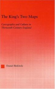
ISBN: 0415967910 9780415967914 0203505425 9780203505427 9786610224098 6610224099 1280224096 9781280224096 1135884951 113588496X 9781135884918 9781135884956 9781135884963 9780415803427 Year: 2004 Volume: 22 Publisher: New York Routledge
Abstract | Keywords | Export | Availability | Bookmark
Loading...Choose an application
- Reference Manager
- EndNote
- RefWorks (Direct export to RefWorks)
This book chronicles the specific technologies, material and epistemological, by which the map - a peculiar artefact, part image and part treatise - shows itself capable of accessing, organizing and reorienting a tremendous range of information.
Cartography --- Cartographie --- History --- Social aspects --- Histoire --- Aspect social --- 912 "04/14" --- 912 <09> <41> --- Cartografie. Kaarten. Plattegronden. Atlassen--Middeleeuwen --- Cartografie. Kaarten. Plattegronden. Atlassen--Geschiedenis van ...--Verenigd Koninkrijk van Groot-Brittannië en Noord-Ierland --- Cartography, Primitive --- Chartography --- Map-making --- Mapmaking --- Mapping (Cartography) --- Mathematical geography --- Surveying --- Map projection --- Maps --- Great Britain
Book
ISBN: 9076341508 Year: 2003 Publisher: Amsterdam Antwerpen Ambo/Anthos Manteau
Abstract | Keywords | Export | Availability | Bookmark
Loading...Choose an application
- Reference Manager
- EndNote
- RefWorks (Direct export to RefWorks)
Dit boek vertelt het unieke levensverhaal van de Nederlands-Vlaams-Duitse grondlegger van de cartografie. De auteur biedt bovendien een schitterend beeld van een tijd van ontdekkingen en ongekende wetenschappelijke en culturele bloei.
Mercator, Gerhard, --- Mercator, Gerard --- 912 <09> <493> --- 929 MERCATOR, GERARDUS --- 912 <09> --- cartografie --- Gerard Mercator --- historische figuren --- geschiedenis --- België --- 937.2 --- 519.3 --- 929 MERCATOR, GERARDUS Biografie. Genealogie. Heraldiek--MERCATOR, GERARDUS --- Biografie. Genealogie. Heraldiek--MERCATOR, GERARDUS --- Cartografie. Kaarten. Plattegronden. Atlassen--Geschiedenis van ...--België --- geschiedenis België - historische figuren : tot 16e eeuw --- Mercator, Gerardus --- Cartografie --- Historische kaarten --- Historische kaart --- 960 --- wetenschapsgeschiedenis --- levensbeschrijvingen --- biographies et mémoires
Book
ISBN: 9789463883399 Year: 2020 Volume: 16 Publisher: Antwerpen Kanselarij Phoebus Foundation vzw
Abstract | Keywords | Export | Availability | Bookmark
Loading...Choose an application
- Reference Manager
- EndNote
- RefWorks (Direct export to RefWorks)
In de zestiende eeuw ontdekt de westerse mens de wereld. De topografie beleeft in die periode een ongekende bloei. Gedreven door nieuwsgierigheid en zich goed bewust van de mercantiele voordelen brengen onder anderen Gerard Mercator en Abraham Ortelius de wereld in kaart. Terwijl zij landen aan de hand van nauwkeurige opmetingen in overzichtelijke kaarten vertalen, kiest de Italiaan Lodovico Guicciardini (1521-1594) voor het woord. In zijn magnum opus, Descrittione di tutti i Paesi Bassi (Beschrijving van de Nederlanden) uit 1588, beschrijft hij letterlijk ‘de hele Nederlanden’. Niets van zijn nieuwe thuisland ontsnapt aan het scherpe oog of de zin voor volledigheid van deze Florentijnse edelman. Niet alleen is de Descrittione daarom een levenswerk om u tegen te zeggen, het was zowel in de zestiende eeuw als vandaag een ontzagwekkende bron van informatie over de Lage Landen.
Book history --- History of the Low Countries --- topography [image-making] --- Nederlanden --- Guicciardini, Ludovico --- 912 <09> <492> --- 912 <09> <493.1> --- 094 GUICCIARDINI, FRANCESCO --- 912 "15" --- 912 "15" Cartografie. Kaarten. Plattegronden. Atlassen--16e eeuw. Periode 1500-1599 --- 912 "15" Cartography. Maps. Atlasses--16e eeuw. Periode 1500-1599 --- Cartografie. Kaarten. Plattegronden. Atlassen--16e eeuw. Periode 1500-1599 --- Cartography. Maps. Atlasses--16e eeuw. Periode 1500-1599 --- 912 <09> <492> Cartografie. Kaarten. Plattegronden. Atlassen--Geschiedenis van ...--Nederland --- 912 <09> <492> Cartography. Maps. Atlasses--Geschiedenis van ...--Nederland --- Cartografie. Kaarten. Plattegronden. Atlassen--Geschiedenis van ...--Nederland --- Cartography. Maps. Atlasses--Geschiedenis van ...--Nederland --- 094 GUICCIARDINI, FRANCESCO Oude en merkwaardige drukken. Kostbare en zeldzame boeken. Preciosa en rariora--GUICCIARDINI, FRANCESCO --- Oude en merkwaardige drukken. Kostbare en zeldzame boeken. Preciosa en rariora--GUICCIARDINI, FRANCESCO --- 912 <09> <493.1> Cartografie. Kaarten. Plattegronden. Atlassen--Geschiedenis van ...--België, provincie Antwerpen --- 912 <09> <493.1> Cartography. Maps. Atlasses--Geschiedenis van ...--België, provincie Antwerpen --- Cartografie. Kaarten. Plattegronden. Atlassen--Geschiedenis van ...--België, provincie Antwerpen --- Cartography. Maps. Atlasses--Geschiedenis van ...--België, provincie Antwerpen --- geschiedenis --- geografie --- Guicciardini, Lodovico --- 16de eeuw --- Zuidelijke Nederlanden --- Antwerpen --- 528.9 --- Cartografie --- Lage Landen --- Lodovico Guicciardini --- 16e eeuw --- geschiedenis. --- geografie. --- Guicciardini, Lodovico. --- 16de eeuw. --- Zuidelijke Nederlanden. --- Antwerpen.
Book
ISBN: 9789004441682 9004441689 9789004441231 9004441239 Year: 2020 Publisher: Leiden ; Boston : Brill,
Abstract | Keywords | Export | Availability | Bookmark
Loading...Choose an application
- Reference Manager
- EndNote
- RefWorks (Direct export to RefWorks)
Mountains appear in the oldest known maps yet their representation has proven a notoriously difficult challenge for map makers. In this essay, Ernesto Capello surveys the broad history of relief representation in cartography with an emphasis on the allegorical, commercial and political uses of mapping mountains. After an initial overview and critique of the traditional historiography and development of techniques of relief representation, the essay features four clusters of mountain mapping emphases. These include visions of mountains as paradise, the mountain as site of colonial and postcolonial encounter, the development of elevation profiles and panoramas, and mountains as mass-marketed touristed itineraries.
912 <09> --- 912 <23> --- History of cartography --- 912 <23> Cartografie. Kaarten. Plattegronden. Atlassen--Gebergten. Bergen. --- Cartografie. Kaarten. Plattegronden. Atlassen--Gebergten. Bergen. --- 912 <23> Cartography. Maps. Atlasses--Mountain Ranges. Mountains --- Cartography. Maps. Atlasses--Mountain Ranges. Mountains --- Cartografie. Kaarten. Plattegronden. Atlassen--Geschiedenis van --- Cartografie. Kaarten. Plattegronden. Atlassen--Gebergten. Bergen --- E-books --- Mountain mapping. --- Cartography.
| Listing 1 - 10 of 18 | << page >> |
Sort by
|